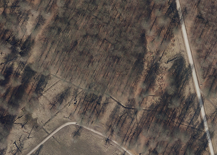
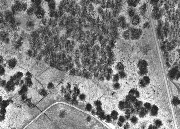
Orthophoto
High-resolution orthophotos from 2024. Images are acquired yearly during spring where the probability for snow is low and the trees are still without leaves.
Resolution: 10 cm
File Format: JPEG (along with separate world file for georeferencing)
High-resolution orthophotos from 2024. Images are acquired yearly during spring where the probability for snow is low and the trees are still without leaves.
Resolution: 10 cm
File Format: JPEG (along with separate world file for georeferencing)
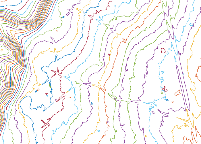
Surface Hight Contours
The contours are generated based on LIDAR data. More filtering steps are applied to provide smoothed and simplified contours while still maintaining the smallest details of interest.
File Format: DXF, vector format
The contours are generated based on LIDAR data. More filtering steps are applied to provide smoothed and simplified contours while still maintaining the smallest details of interest.
File Format: DXF, vector format
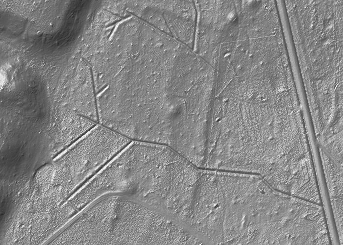
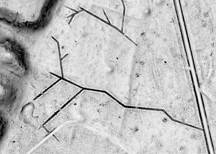
Analytical Hillshading
Visualization of the ground surface using analytical hillshading (AHS) algorithm. The processing is based on LIDAR data.
Analytical hill-shading is the most frequently used relief visualization technique. It is based on the direct illumination that makes possible to intuitively recognize relief features. However, it also has several drawbacks. The most critical are its inability to represent linear objects that lie parallel to the direction of the light source and saturation of shadow areas.
Resolution: 50 cm
File Format: GeoTIFF (Tagged Image File Format)
Surface Relief Visualization
Visualization of the ground surface using the Sky-View Factor (SVF) algorithm. The processing is based on LIDAR data.
Contrary to analytical hillshading, the SVF technique is based on diffuse illumination that overcome the problems that originate in the charcteristics of direct illumination.
Resolution: 50 cm
File Format: GeoTIFF (Tagged Image File Format)
LIDAR Intensity Image
LIDAR intensity imagery (LIN) is generated from LIDAR reflection information. The grayscale in the image correspond to the intensity of the reflected laser pulse. White pixels in the image means that a strong reflection is observed from the aircraft while black pixels correspond to weak reflections. LIN is well suited for identification of clearings and vegetation boundaries. LIN is also able to reveal details in underwood, i.e. low vegetation covered by a canopy of high trees. Furthermore, vague wet areas do often become apparent in LIN.
Resolution: 50 cm
File Format: GeoTIFF (Tagged Image File Format)
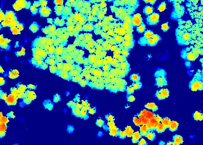
Canopy Height Model
The canopy height model (CHM) is a visualization of the vegetation height. The product is well suited for identification of clearings and vegetation boundaries. The treetops of individual trees can be distinguished in the product. The model is based on classified LIDAR data where a ground surface height elevation model is subtracted from the absolute height of the canopy which results in the height of the vegetation. A number of intermediate processing steps are applied to provide a pit-free model.
Resolution: 50 cm
File Format: GeoTIFF (Tagged Image File Format)
Basemap
Overview map in terms of Geodatastyrelsen's Kort25 which is an auto generated basemap in scale 1:25.000. This product gives a fast overview of the area of consideration.
Resolution: 125 cm
File Format: JPEG (along with separate world file for georeferencing)
Overview map in terms of Geodatastyrelsen's Kort25 which is an auto generated basemap in scale 1:25.000. This product gives a fast overview of the area of consideration.
Resolution: 125 cm
File Format: JPEG (along with separate world file for georeferencing)
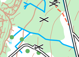
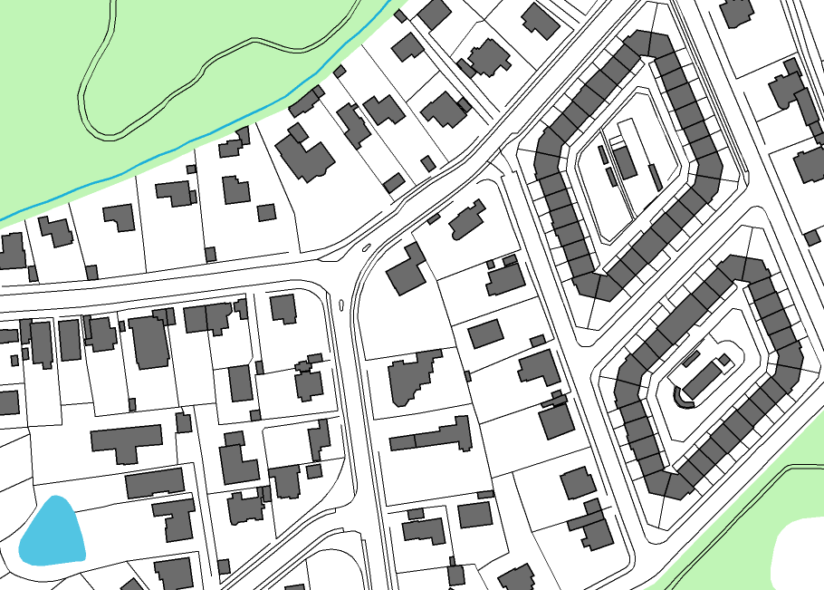
Vector Data (FOT)
Various data in vector format describing features such as building outlines, roads, railways, and water boundaries. The data is an extract of Danish public FOT dataset.
File Format: DXF, vector format
Various data in vector format describing features such as building outlines, roads, railways, and water boundaries. The data is an extract of Danish public FOT dataset.
File Format: DXF, vector format